
Jack Dangermond
Esri Founder | Pioneering Geospatial Technology for a Sustainable Future
Has stood on these stages
About
Jack Dangermond has dedicated his career to advancing geospatial technology as a tool for understanding and improving our world. As the founder of Esri, he has been instrumental in developing mapping and geographic information systems that help organizations visualize, analyze, and interpret data about our planet.
Dangermond's vision extends beyond traditional mapping to encompass what he describes as "an ever-evolving map of everything on Earth" - a comprehensive geospatial framework that could function as a nervous system for our planet. His work focuses on how this interconnected mapping technology can be leveraged to design better solutions for environmental challenges and sustainable development.
Through his presentations at events like the Countdown Summit and TED initiatives, he demonstrates how geospatial intelligence can provide critical insights for addressing climate change and creating a more sustainable future. His approach combines technological innovation with environmental stewardship, showing how detailed geographic data and real-time monitoring systems can inform decision-making at every level, from local community planning to global environmental policy.
What Jack Talks About
Building comprehensive geospatial mapping systems for environmental monitoring
Creating a "geospatial nervous system" for real-time planetary data collection
Using geographic information systems to design sustainable solutions
Leveraging mapping technology for climate change response and adaptation
Integrating geospatial intelligence into environmental decision-making processes
Featured2 with video
An ever-evolving map of everything on Earth
What if we had a map of ... everything? Jack Dangermond, a visionary behind the geographic information system (GIS) technology used to map and analyze all kinds of complex data, walks us through the interconnected technologies gathering information about every crack and corner of the Earth. Learn how this "living atlas" and "geospatial nervous system" can help us better understand our changing planet -- and let nature guide our actions towards a more sustainable future.
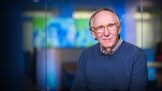
2 talks, 2020 to 2021
This is only what we could find published. Jack has almost certainly done more.
What events has Jack spoken at?
2 events · 2020 to 2021
Is this you?
Claim this profile to edit your bio, add talks, and get verified.
Free. We don't charge speakers to be listed.
Know a talk we're missing?
At a Glance
Save for Later
Similar Speakers
Related by topic and shared stages


Explore related directories
Conferences, directories, and industries connected to Jack Dangermond